Trail Adopters

Award-winning Rollins Pass trail adopters and route historians Kate & B. Travis Wright maintain N76 and support the Fjällräven Classic USA.

N76 TRAIL ADOPTION AND MORE ABOUT THE TRAIL

Since 2016, we’ve participated in helping preserve the Rollins Pass story by serving as trail adopters of N76, a 1.73 mile Class 2 Trail known as Riflesight (named for the famed Riflesight Notch Trestle), on the west side of Rollins Pass. The trail is part of the Adopt-A-Trail Program (AATP) administered under the auspices of Headwaters Trails Alliance (HTA) and the United States Forest Service (USFS)—all work is done on a volunteer basis. For their efforts in 2023, the Wrights received the Partner of the Year award from Headwaters Trails Alliance.

The Riflesight Trail, while open to bicycles and hikers, is closed to all forms of motor vehicle traffic. Per Stay the Trail Colorado, Motor Vehicle Use Maps (MVUMs) are the legal trails you can recreate on—anything off that is out-of-bounds. Please abide by these limitations for the benefit of our continued access. Be sure to leave no trace.

Parking at the trailhead is first-come, first-served and extremely limited, accommodating a maximum of 2 vehicles. However, if a larger group is traveling together in multiple vehicles, it may be possible to fit up to 4 vehicles by “blocking in” the first vehicle with the consent of the driver. Additional overflow parking is available one-quarter of a mile downhill from the trailhead, if needed. Per the US Forest Service, please don’t block gates, “make sure to pull fully off roads, even gated closed roads, to ensure you don’t limit service and emergency access.” A recent scenario proving the importance of not blocking gates was in July 2021 at the trailhead to N76; a lightning strike started a forest fire and emergency crews needed urgent access to this part of Rollins Pass. Thankfully, the rapid response ensured the fire was contained and extinguished at just a quarter-acre in size.

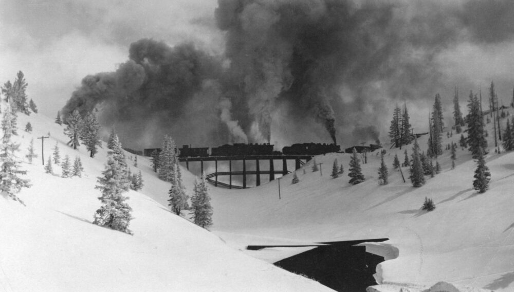
The trail skirts the edge of the timberline at 10,600-10,950 feet in elevation and follows the original railroad grade, making it wide enough for walking next to a hiking partner in most places. The path overlooks two wreck sites: the remnants of Mallet No. 208 and its tender that derailed in 1922, and Mallet No. 210 that derailed in 1924. It continues over two small ‘twin’ trestles and several sections where railroad ties still remain in the ground. The route technically ends at the collapsed Tunnel No. 33, which was once beneath the Riflesight Notch Trestle. However, more adventurous hikers can follow a steep and narrow path on the left that leads to the decking level of the trestle, located approximately 150 feet above the N76 trail.

A quick note on artifacts you may find on and near the trail: The Rails that Climb: A Narrative History of the Moffat Road by Edward Bollinger is a Rollins Pass fan favorite. Reverend Bollinger mentions the 1924 derailment of Mallet No. 210 and, on page 206, writes that “you can pick yourself a souvenir today, for some of her junk is still there.” The unfortunate reality is Bollinger’s recommendation now contradicts established laws that protect artifacts and sites such as the final resting place for Mallet No. 208 and Mallet No. 210. If you find something notable, please leave it in place and use our form to Contact an Archaeologist.

Please be aware that bears may be present, along with territorial moose on this trail. The steep terrain can limit your options for avoidance, so you may need to backtrack, wait for the animal to move along, or change your hiking plans. If you’d like to pitch in to help or would like to keep us company while discussing the 12,000 years of history on the pass, please contact us!

ADDITIONAL DERAILMENTS AND RAILROAD INCIDENTS ON N76

In addition to the incidents involving Mallets 208 and 210 (detailed above), N76 has experienced several other incidents and derailments from the time period that Rollins Pass served as a railroad route up, across, and down the Continental Divide in Colorado:

  • As told in the February 1, 1912, Oak Creek Times: “Carson Friend, a freight fireman, has a broken shoulder, the result of jumping from his engine west of Corona, because of the train running away. Engineer George Clark also jumped, but the brakeman and conductor stuck to their posts, and stopped the train at the Loop. Mr. Clark turned in his resignation upon reaching Fraser.”
  • Near the twin trestles on the Loop, an ill-timed boulder’s tumble derailed the downhill-bound No. 302 and its schedule. A rare photograph of this event that did not seem to make it into the newspapers can be found on page 79 of our second book.
  • Around the midpoint of N76, a train became trapped in an avalanche, causing several coal cars to tumble down the slope.

HEADWATERS TRAILS ALLIANCE’S PARTNER OF THE YEAR (2023)

Entrance to N76 on Rollins Pass West; Travis and Kate with their rescue pup, Moffat

B. Travis Wright and Kate Wright were recognized and presented with the Partner of the Year award by Headwaters Trails Alliance for their work on Rollins Pass in 2023.

“The Rollins Pass project was by far, our biggest boots on the ground project of the season. We built 860-feet of buck and rail [fencing] up on Rollins and we couldn’t have done it without these two people [Travis and Kate Wright]. We partnered with them to do all the planning, get all the logistics for where we were going to place the fence, and Travis [delivered the keynote address] at our Trails Symposium in September.”

TYPICAL TRAIL SEASON INFORMATION

SUMMER/AUTUMN

The trail is mostly hikeable beginning the last week in June—however, there are some sizable snowdrifts that must be crossed. N76 is fully clear of snow by the second week in July. As the trail is mostly shaded in the afternoons, it typically holds any snow received after mid-September and becomes difficult to hike without snowshoes following substantial snowfall. Please note that while this trail is close in proximity to the town of Winter Park, due to terrain, cellular coverage is extremely limited. The trail is also quite exposed during a lightning storm and has no safe shelter.

WINTER/SPRING

Snowmobile use is permitted when snow depth is 12″ or greater—however, the trail is not groomed and avalanches have occurred on this trail historically, with enough force to derail multiple rail cars.
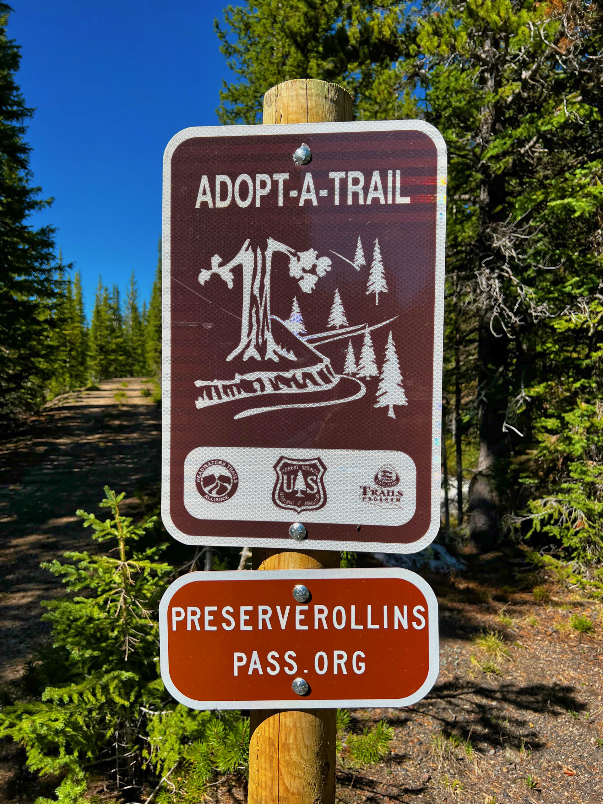
Adopt-A-Trail Preserve Rollins Pass
Adopt-A-Trail | Trail Adopted by Preserve Rollins Pass

ROUTE HISTORIANS

FJÄLLRÄVEN CLASSIC USA

Fjallraven Classic USA Logo

Since 2022—the inaugural year for the course over Rollins Pass—we’ve served as the official Rollins Pass route historians for the 30.5 mile course comprising Fjällräven Classic USA. From Fjällräven, “The first Fjällräven Classic was held in 2005 and brought together 152 participants. The idea then, as now, was to wander in uncharted territory, over grand vistas framed by glacier-covered peaks and studded with sparkling lakes. But importantly, it was an opportunity to share the experience and the sense of freedom that comes with it with other trekkers. By taking care of all the logistics, like food, transport and safety, participants could focus fully on the trekking experience. The event was a success and during the following years, the idea was born to spread Fjällräven Classic to other places around the globe. After all, northern Swedish Lapland is quite far away for a lot of people.” As a result, you can now find Fjällräven Classic in Denmark, Sweden, UK, Chile, Germany, South Korea, and USA too.

The Fjällräven/Fjallraven Classic USA on Rollins Pass is a once in a lifetime experience—umlauts optional! Read about two hikers’ experience on the Fjallraven Classic USA traversing Rollins Pass in 2023 here and here. The hike draws people from around the world.

Fjällräven Classic USA operates under a US Forest Service Special Use Permit.

Fjällräven Classic USA

The Fjallraven Classic usually takes place during the last full week of July each year, though this is subject to change. The event begins on Monday and concludes on Friday. Heavy hiking traffic occurs on the east side of the pass from Tuesday to Friday, while the summit areas and the west side of the pass experience heavy hiking traffic from Wednesday to Thursday. Throughout multiple days, 300 hikers traverse the timeless landscape, rigorously following Leave No Trace principles. They go above and beyond by not building campfires, using wag bags instead of digging cat holes, picking up non-historic trash, storing all food, deodorant, and toothpaste into bear vaults, and ensuring that dishwashing and urination are done at least 200 feet away from water sources.

FJALLRAVEN USA ROUTE STATISTICS

Day 1 (Rollins Pass East Entrance to Yankee Doodle Lake): 9.8 miles; 2,512 feet of elevation gain
Campsite 1: Yankee Doodle Lake on Rollins Pass East at approximately 10,700 feet in elevation
Day 2 (Yankee Doodle Lake to Corona Lake then to Jenny Lake): 11.6 miles; 2,217 feet of elevation gain/loss
Campsite 2: Jenny Lake on Rollins Pass East at approximately 10,930 feet in elevation
Day 3 (Jenny Lake to Rollins Pass East Entrance): 10.7 miles; 2,691 feet of elevation loss
Totals: 32.1 miles; 7,420 feet of elevation change

INDIAN PEAKS TRAVERSE

We’re providing route history for Segment 4 and Segment 5 to the Indian Peaks Traverse team as they seek to utilize Rollins Pass as a crossing over the Continental Divide for their 66-mile hiking and mountain biking trail that meanders from Boulder, Colorado over the Rocky Mountains and into Winter Park, Colorado.

The primary purpose of our work is to inform the public.
Preserve Rollins Pass background image
No campfires allowed anywhere on the pass: Stage 1 fire restrictions in effect for all USFS lands on the west and east sides, including Grand, Boulder, & Gilpin Counties.
close
open