Frequently Asked Questions
Your most frequently asked questions (FAQs) about Rollins Pass and the Moffat Tunnel, answered here! Please email [email protected] with any additional questions.
Content on this page is updated regularly; last reviewed/updated: Sunday, March 3, 2024. Please note: new content is added throughout this page and not necessarily placed at the bottom of each section. Do you have a question that could be or should be answered on our frequently asked questions page? Reach out to us!
Looking for something specific? Use your browser’s search feature to locate a keyword—or keywords—of interest. If limited search terms are returned, try synonyms: e.g. vehicle instead of truck.
INDEX OF TOPICS
- Rollins Pass (Corona Pass)
- Moffat Tunnel
- Purchasing our Autographed Books
- General Topics
- Have further questions?
ROLLINS PASS: FREQUENTLY ASKED QUESTIONS (FAQs)
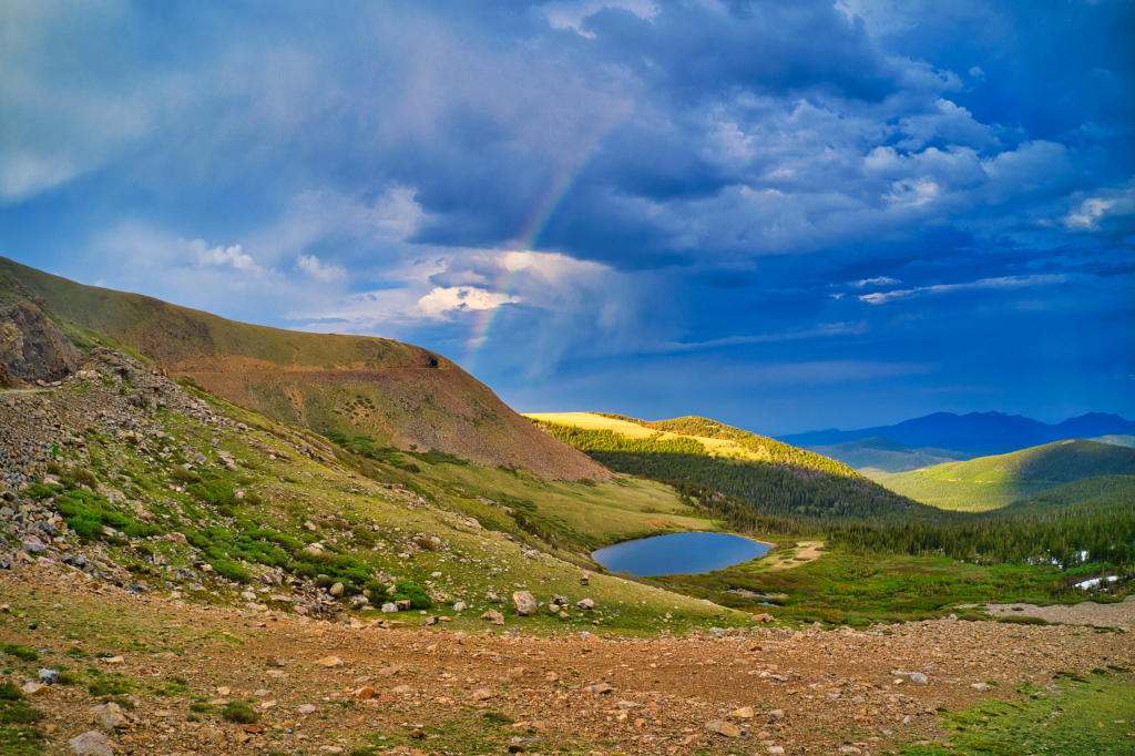
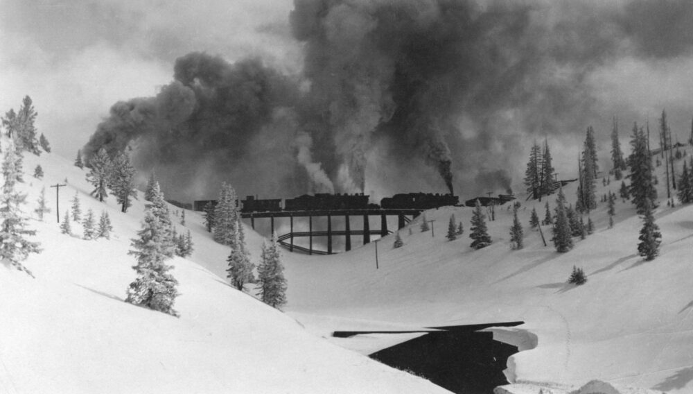
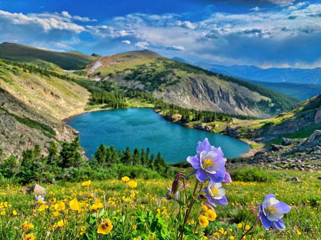
Rollins Pass is considered a sacred area by both Ute as well as Arapaho tribes.
Rollins Pass has been known by several names. Boulder Pass was the original name, which later became Rollins Pass, named after John Quincy Adams Rollins. The railroad station at the summit was named Corona, consequently Corona Pass is a variant name used by the railroad for tourism purposes. Mountain passes are not customarily named for their apex stations: Fremont Pass, not Climax; La Veta Pass, not Fir; and Rollins Pass, not Corona. Today, Grand County refers to the pass by this appellation almost exclusively. Area author Frederick Bauer bluntly wrote, “[Rollins Pass is] incorrectly called Corona Pass by neophytes and some locals.”
Rollins Pass is the official name used by the US Geological Survey and is also the name officially recognized by the US Board on Geographic Names. In fact, the name “Corona Pass” does not exist in the official federal government geographic nomenclature—only Rollins Pass. The use of the correct name is also a safety issue: avalanche bulletins and news articles make reference to ‘Rollins Pass’ only.
Corona Pass, Boulder Pass, and South Boulder Pass. Little-used sobriquets include Rollinsville Pass, Dart Pass (sometimes Dartt Pass), and Moffat Pass.
Few know of the thousand-year-old Native American hunting structures scattered across Rollins Pass. C.A. Deane, a government surveyor, first interpreted the Rollins Pass game drive complex in 1869, and his interpretation was rounded out by “Commodore” Decatur, a trader familiar with Native American traditions. John Rollins himself described the walls in 1873. Archaeologists Byron Olson and James Benedict worked on Rollins Pass through the 1960s and 1970s, and in 2009, professional archaeologist Dr. Jason LaBelle assessed the Rollins Pass region for archaeological reinvestigation. Since then, Dr. LaBelle has documented miles of rock walls and hundreds of hunting blinds, strategically placed by the indigenous peoples to prey upon migrating animals. He stated these game drives are “one of the greatest concentrations of ancient hunting structures documented in North America.”
John Quincy Adams Rollins was born in New Hampshire and joined the ranks—and naturally the history books—as a pioneer from a family of Colorado pioneers. In Middle Park, Rollins built the first bridge over the Grand (Colorado) River; in Rollinsville, Rollins was elected mayor in 1881. Four days after his 78th birthday, Rollins died on June 20, 1894, and is buried in Denver’s oldest operating cemetery, Riverside, in block 5, lot 12. His simple tombstone reads, “John Q.A. Rollins | Colorado Pioneer of Rollinsville and Rollins Pass,” yet his legacy is bequeathed to future generations; the spirit of Rollins is eternal.
David Halliday Moffat Jr. was born on Monday, July 22, 1839, in Washingtonville, New York. Moffat himself was a warm, larger-than-life character who was never too busy to listen and lend assistance whenever possible; a man like this becomes legendary and begets legends. Moffat’s leadership style was atypical of a company president—past or present. Railroad workers recalled that he would regularly chat with them in the crew compartment of the locomotive, as the train moved from town to town. When Moffat’s investors were riding in his private railroad car, Marcia, Moffat insisted that his workers ate before anyone else. Moffat’s first-class treatment of his mountain men guaranteed they gave him their very best as well. Moffat hired youth with youthful indiscretions. Dan Crane, a former Santa Fe Railway worker, came to Moffat with papers, “Discharged for insubordinating [sic] the road foreman of engines and drinking intoxicating liquors to excess. Services otherwise satisfactory.” Crane was hired and worked as an engineer and fireman on Rollins Pass.
The Moffat Cup is currently on loan from History Colorado (accession #H.3028.1) and is on display at Denver’s Union Station across from the Amtrak counter. The 230-pound cup is made of solid silver with a marble base and was re-introduced to the public on Friday, September 6, 2019. At the unveiling ceremony, Rollins Pass and Moffat Tunnel historian B. Travis Wright mentioned, “Preservation is paramount and something to be celebrated: this immaculate cup exists today because someone many generations ago, thought it wise to preserve it for us; the same approach must be taken when considering how best to preserve this Great Gate that we call Rollins Pass.”
Rollins Pass is a mountain pass located in the Southern Rocky Mountains of north-central Colorado, located on the Continental Divide roughly east of Winter Park and west of Rollinsville.
Rollins Pass spans three different counties: Gilpin County, Boulder County, and Grand County.
The elevation of 11,660 feet often shown in historical photographs reflects what might have been an original survey value obtained during either the late wagon road era or early railroad construction. A 1912 map shows 11,680 feet, but that is not based on a surveyed benchmarked location and was an estimated value based on nearby contours. The actual benchmarked survey elevation value of the summit of Rollins Pass is 11,671 feet (NGVD29), obtained during a 1952 second-order level line run from State Bridge to Denver by the US Coast and Geodetic Survey (predecessor to the National Geodetic Survey). When adjusted to NAVD88, the elevation is, without doubt, 11,676.79 feet.
Despite what Google Maps or Apple Maps may show, since 1990, a complete motorized thoroughfare over the Continental Divide no longer exists; you must go back down the same side you came up. Always consult the published Motor Vehicle Use Maps (MVUMs) linked to on this page. Permanent Closures: Year-round closures to travel by wheel-to-ground vehicles per 36 CFR 261.54a (Forest Closure Order 10-00-03) include:
• NFSR 149: Permanent closure 1 mile south of Needle’s Eye Tunnel to the Continental Divide
• NFSR 501: Boulder Wagon from its intersection with the Rollins Pass Road at Yankee Doodle Lake west to a point 1/2 mile west of the Needle’s Eye Tunnel)
No motorized route connects across the Continental Divide. Per Stay the Trail Colorado, MVUMs are the legal trails you can recreate on—anything off that is out-of-bounds. Please abide by these limitations for the benefit of our continued access.
In short: Needle’s Eye Tunnel. Significant rockfalls occurred at the northeast portal of Needle’s Eye Tunnel by 1949 as well as in 1979, closing the route for nearly a decade for three different studies, engineering design, and finally rehabilitation work. Rehabilitating the tunnel triggered the Section 106 process, as any actions or proposed alterations must be federally reviewed. In the 1980s, it was documented this tunnel “is in an advanced state of deterioration,” has a “very irregular geometry,” and “much of the surface rock structure, around the portals, was damaged and weakened during construction by the excessive use of explosives in blasting.” At 11,350 feet above sea level, extreme freezing and thawing in rock fractures occurs, further accelerating the weathering process, and “the centerline of the tunnel is essentially parallel to the joint sets in the rock, which tends to create a weakened surface condition.”
Unfortunately, tunnel restoration errors led to a partial collapse, resulting in a below-knee amputation of assistant fire chief Tom Abbott in 1990. Abbott expressed, “I was lucky the firefighters [who were with me] had what it takes. They and two civilians stood in there while the ceiling was still falling and dug me out… of the pile of ‘coffee-table-sized rocks.’ ” Later that same year, a post-accident engineering report cited “faulty work: design specifications were not consistently followed… rock bolts were incorrectly spaced… gravity along with seasonal temperature variations were… factors in the accident.”
Since July 15, 1990, the tunnel has been closed and subsequently barricaded, preventing motor vehicles from crossing the Continental Divide. Given the challenging and unique terrain of the Rollins Pass route, there are no options to bypass the troublesome tunnel to the left or right: the narrow road and tunnel are on a steep shelf—a 400-500 foot drop-off exists on one side of the road while a 100-foot-tall hillside where wilderness begins is on the other side of the road.
The Needle’s Eye Tunnel has had a bloody history. As reported in the Steamboat Pilot, a road contractor “once saw 60 Swedes carried out in baskets, killed when a charge of powder exploded prematurely in boring this tunnel.” Almost 13 unlucky years later, a freight derailment occurred inside Needle’s Eye Tunnel as reported by the Oak Creek Times. When visiting the tunnel, history can still be seen—soot-stained rocks bear silent witness to David Moffat’s pioneering strategy of running rails at historic altitudes.
No, this portion of the Rollins Pass route has been closed to all motorized vehicles since 1980 as indicated on Motor Vehicle Use Maps. Hikers, bicyclists, dog walkers, and horseback riders are allowed to travel this route over the Devil’s Slide Trestle and Phantom Bridge. Per Stay the Trail Colorado, MVUMs are the legal trails you can recreate on—anything off that is out-of-bounds. Please abide by these limitations for the benefit of our continued access.
Rollins Pass is seasonally open for wheeled motorized vehicle use from June 15-November 15; however, late snowfalls can and have resulted in later openings towards early July and/or early snowfalls can and have closed the pass in September. (Note the thoroughfare closures, documented directly above.) Up-to-date information about the Rollins Pass Road Status is published year-round, here.
The US Forest Service information line for the Arapaho and Roosevelt National Forests is 970-295-6600. Their road status pages are updated very infrequently; click here for the Sulphur Ranger District (Rollins Pass West) and here for the Boulder Ranger District (Rollins Pass East). The “Annual Anticipated Opening Date” for Rollins Pass East is shown on the Boulder Ranger District page as May 1, however, due to substantial snow in the rock cuts, the road is not typically open to Yankee Doodle Lake until around June 21-28 each year.
Yankee Doodle Lake both inspires and stores apocryphal stories about submerged wrecks contained within, including a 19th-century wagon, a 20th-century locomotive, and even an airplane. All variations of the anecdotes follow an identical trajectory, “if the light is just right.” However, all that can be seen in the lake is the reflection of a visitor yearning for a deeper connection to the area’s vast history.
There were early attempts at running narrow-gauge rails over the pass in the early 1880s, but those efforts met with failure. The Moffat Road rail route over Rollins Pass was the highest adhesion (non-cog) standard gauge railroad grade in North America.
For the 1980 listing, the main page of assets can be found here; with direct links to the form/text here and the accompanying images here. For the 1997 boundary increase, the main page of assets can be found here; with direct links to the form/text here and the accompanying images here.
No, these areas are private property and are not open to the public; please respect the privacy of the owners and their neighbors.
Developed campsites typically have metal fire rings, picnic tables, numbered posts, garbage service, toilets, and bear-proof trash receptacles—there are no developed campsites on Rollins Pass. All camping is classified as ‘primitive’ and is only available in certain areas. Refer to the Motor Vehicle Use Maps for Rollins Pass West and Rollins Pass East for areas where camping is allowed. Any primitive sites are subject to not only first-come, first-serve and must also follow any applicable fire bans. Stage 1 (and above) fire bans prohibit fires at non-developed campsites. Visitors are required to properly store and pack out all food and trash to prevent negative interactions with bears and other wildlife. Rocks do not make a permanent fire ring. Do not camp or build campfires within 100 feet of developed trails or bodies of water, per US Forest Service rules.
A high-clearance vehicle is recommended to avoid bottoming out on the rough road. An all-wheel drive or four-wheel drive vehicle isn’t absolutely required. As the road condition on both sides continues to deteriorate, an ATV or SxS has become the preferred method of travel for many visitors to Rollins Pass. Luxury vehicles, sports and performance cars, sedans, station wagons, and coupes are not recommended.
Registered off-highway vehicles are welcome on Rollins Pass and all motorized vehicles (which now includes e-bikes) must adhere to Motor Vehicle Use Maps (MVUMs) linked to on this page; however, vehicles traveling on Rollins Pass are ‘off pavement’ rather than ‘off road.’ Stay the trail: the sensitive alpine tundra can take 100-500 years to fully recover. Per Stay the Trail Colorado, MVUMs are the legal trails you can recreate on—anything off that is out-of-bounds. Please abide by these limitations for the benefit of our continued access.
No, the historic grade used long ago by the railroad (as well as the portions of the wagon road able to be traveled by motorized vehicle) are not paved and see little to no maintenance or improvements; for the average driver, the route will take over an hour uphill and about an hour downhill. The road is quite rough and a high-clearance vehicle is strongly recommended. Luxury vehicles, sports and performance cars, sedans, station wagons, and coupes are not recommended.
There is good reason the roadbed of Rollins Pass is rough—the road prism contains both prehistoric and historic artifacts buried under the surface. Improving the road through regrading would first require sectional archaeological excavations. In several places, on or just under the surface, historical artifacts are covered with geotextile stabilization fabrics having characteristics that match the soil and permeability of the existing roadbed.
Rollins Pass has no amenities. There are no emergency call boxes, shops, food, vending, restrooms, water fountains, fuel, electric vehicle charging stations, shelter (with the exception of the Årestua Hut on Guinn Mountain), benches, picnic tables, trash receptacles, established campgrounds, pet waste bags/stations, nor AEDs. While the west side of the pass has decent cellular coverage for most carriers; areas near the summit and on the east side of the pass have no or very limited cellular coverage.
The closest refuge for hikers, mountain bikers, snowshoers, and other backcountry travelers can be found at the historic Årestua Hut, also known as the Guinn Mountain Hut, located on Guinn Mountain on Rollins Pass East. While this hut and nearby outhouse were once open year-round on a first-come, first-served basis, sadly the hut has transitioned to being closed from late May through early November because of bear activity in the summers. For additional information about the hut, its rules and amenities, trails nearby and more, click here.
Rollins Pass is sandwiched between the Indian Peaks Wilderness, created in 1978, and the James Peak Wilderness, established in 2002.
Recommendations include, but are not limited to: a first aid kit, cold weather clothing (hats, gloves, jacket)—the temperature can drop precipitously even in July/August, strobes that can be seen for 3+ nautical miles, 360° lightning detector, GPS or offline maps, a fully-charged mobile phone, SARSAT rescue beacon, two RECCO reflectors (per person), emergency blankets, spare batteries, LifeStraw purifier, as much water and/or Gatorade as you can carry, and food/snacks. Expert advice on what to wear for hiking is provided here by REI. To add some historical context, a tourist visiting Corona in the summertime wrote for the August 3, 1911, Greeley Tribune, “As all those who have taken this trip know, it is one of the most scenic mountain trips in Colorado, where mountain scenery is a chief product. . . . Snow banks and wild flowers, as the literature tells you, is right.” Concluding, “The next time [the author] goes to Corona he will borrow an overcoat to take along, for there ain’t no summer up there.”
All of the items listed directly above, plus a GPS and a 360° lightning detector.
At least 10 gallons of fresh drinking water, three LifeStraw purifiers, a second SARSAT rescue beacon, spare strobes that can be seen for 3+ nautical miles, emergency blankets, duffel bags full of warm clothing, a more expansive first aid kit, towing equipment, snow shovels, charging equipment and spare batteries, as well as an AED. These items are for situations when others may need something more than we do—quite often, there have been days when our spare water supply has been fully depleted.
Recommendations include, but are not limited to: an avalanche transceiver, probe, and shovel, as well as an avalanche backpack. Plus the basics: a first aid kit, cold weather clothing (hats, gloves, jacket)—the temperature can drop precipitously even on sunny, warm spring days; strobes that can be seen for 3+ nautical miles, GPS or offline maps, a fully-charged mobile phone, SARSAT rescue beacon, two RECCO reflectors (per person), emergency blankets, spare batteries, as much water and/or Gatorade as you can carry, and food/snacks.
Per RECCO® Backpack Rescue Reflector packaging: The RECCO® technology is used by rescue professionals worldwide. Visit RECCO.com to view the complete list of locations and areas covered. RECCO® reflectors makes you searchable to rescue professionals using RECCO® detectors in the event of an avalanche accident or when lost in the outdoors. RECCO® technology does not prevent avalanches or guarantee the survival or localization of a victim or lost person. Knowledge and common sense are the best ways to avoid accidents. Always respect safety rules and regulations.
The RECCO® reflector requires no activation to function and has a virtually unlimited lifespan. More than 200 of the world’s leading outdoor brands integrate RECCO® reflectors into their products. Multiple reflectors on opposite sides of the body are recommended, for optimal performance. A backpack RECCO® reflector complements your avalanche transceiver and any RECCO® reflectors already integrated in your gear. RECCO® TECHNOLOGY IS NOT A SUBSTITUTE FOR AN AVALANCHE TRANSCEIVER.
The patented RECCO® technology is a two-part system, featuring an active detector, carried by the rescuer, and a passive reflector, carried by the user. Learn more at: https://recco.com/technology/
RECCO® reflectors have been used to help locate victims beneath two feet of avalanche debris on Rollins Pass as recently as 2023: read the CAIC report.
Assuming your beacon is a 406 MHz rescue beacon, registration, renewal, editing of emergency contacts, and more can be done on NOAA’s website here. As a reminder, registration renewal is every 2 years.
Avalanches have occurred on both sides of Rollins Pass. In fact, avalanches were the cause of at least four railroad wrecks: near Jenny Lake in March 1913 and December 1919, near Yankee Doodle Lake in December 1917, and near the Loop in February 1922. There have also been several deadly avalanches in the post-railroad era: November 2001 at Yankee Doodle Lake (triggered by skiers), as well as February 2021 and January 2023 at Mount Epworth and Pumphouse Lake (triggered by snowmobilers).
No, this tunnel has been barricaded at both portals due to safety concerns—officials are prevented from allowing the public to utilize facilities known to be hazardous. On July 15, 1990, Denver firefighters were passing through Needle’s Eye Tunnel on a summer mountain Jeep tour when several thousand pounds of rock unexpectedly fell from the ceiling of the tunnel injuring Assistant Fire Chief and US Navy veteran Tom Abbott, resulting in a below-knee amputation. More recently, significant rockfalls occurred between 2017 and 2018 in the center of the tunnel.
The overall road that can be driven: 27.7 miles; however, no motorized route connects across the Continental Divide. On the west side, it is 13.9 miles to the summit, plus an additional 1.7 miles from the summit to the blockade at the overlook above Yankee Doodle Lake. On the east side, it is 12.1 miles to the blockade before Needle’s Eye Tunnel.
There are three seasonal gates across the historic road on the western portion of Rollins Pass. The first gate is found at the entrance to the pass, located almost immediately off of US Highway 40. From this gate, it is 13.9 miles to the summit. The gate at the entrance typically opens in early-mid June. Next is the “midway” gate, located 5.5 miles up the road, just before the Forest and Morgan Spurs, and is 8.4 miles away from the summit. This gate typically opens June 15th, however, in some years this gate has opened several days after the 15th of June. Finally, there’s a gate just below the Riflesight Notch Trestle, 10.2 miles from the entrance; from here, the summit is 3.7 miles away. This gate typically opens between the 15th and the 21st of June each year. The first gate is located at approximately 9,008 feet in elevation; the midway gate at approximately 10,013 feet; and the trestle gate at 11,001. Therefore, the “midway” gate is essentially midway in elevation between the upper and lower gates, not in road distance from the entrance to the summit.
Yes—typically the first of three gates is open (the one at the western entrance of Rollins Pass off of US Highway 40), and every few years one or more gates on Rollins Pass are not open by June 15. When this happens, there’s usually an additional sign posted on the gate that reads, “Extended closure due to snow, runoff, and road damage—36 CFR 261.54(a).”
Rollins Pass is not open on Memorial Day weekend. On the west side, the gates blocking the road are typically opened on or around June 15th; on the east side, there are no gates, however, due to substantial snow held in the rock cuts, the road is not typically open to Yankee Doodle Lake until around June 21-28 each year.
Rollins Pass is mostly open on Independence Day (July 4th). Over the last rolling decade, Rollins Pass West has been open to at least Sunnyside, located above the Riflesight Notch trestle, and usually to the summit. On the east side, Rollins Pass is typically open to Yankee Doodle Lake but is closed (by snow) at the rockcut past Yankee Doodle Lake and therefore is not passable above that point to Jenny Lake and the Forest Lakes, until about July 8-12th. Above the Forest Lakes area, snow in some years has prevented access to the highest point on the east side until the first or second week in August.
Rollins Pass is open on Labor Day as last winter’s snows have at last melted in all rock cuts. Early season snow storms can sometimes put higher elevations out of reach, but both sides of the pass are typically open to above 11,200 feet after any snow events in early September and any snow received typically melts within a few days.
Rollins Pass is typically not open to the highest points on either side of the pass on Halloween. In most years, it’s not possible to go much higher than the Riflesight Notch Trestle on the west side and Yankee Doodle Lake on the east side. However, each year is a bit different and we invite you to check our Rollins Pass Road Status page for the latest information.
The Rollins Pass Road (Corona Pass Road) typically closes after the first few snowstorms in late September, October, or early November. In our experience, snowfall on the pass has closed the area as early as the third week in September or as late as the first week in November—and anytime in between. The gates on the west side of the pass are scheduled to always close November 15th each year. As a general rule, any snowfall received before the autumnal equinox (September 21-24) tends to melt; anything after that date tends to stick around, especially in areas that don’t receive direct sunlight. Any trips above 11,000 feet on Rollins Pass after the equinox should be considered bonus time on the pass.
Campfires are always prohibited in the James Peak Wilderness per this US Forest Service page. Campfires are also prohibited in the Indian Peaks Wilderness on/near Rollins Pass by King Lake, Betty Lake, Bob Lake, Buttermilk Falls, Skyscraper Reservoir, Woodland Lake, and along the South Fork of the Middle Boulder Creek—these areas are in the Woodland BZ and Middle Boulder BZ where campfires are prohibited per this US Forest Service map; the only exception is on the ridge west of the Continental Divide (above Corona Lake), known as the Columbine Backcountry Zone (BZ).
Yes, camping permits are required from June 1 to September 15 in the Indian Peaks Wilderness. Permits can be obtained at recreation.gov.
The Rails that Climb: A Narrative History of the Moffat Road by Edward Bollinger is a Rollins Pass fan favorite. Reverend Bollinger mentions the 1924 derailment of Mallet No. 210 and, on page 206, writes that “you can pick yourself a souvenir today, for some of her junk is still there.” The unfortunate reality is Bollinger’s recommendation now contradicts established laws that protect artifacts and sites such as the final resting place for Mallet No. 210. Rollins Pass is listed in the National Register of Historic Places and all artifacts—from the prehistoric to the historic—are objects of antiquity and are protected by many cultural laws. The pass contains countless treasures, which are being studied and documented by universities and government agencies. Sadly, the material record of Rollins Pass is illegally carried away each year in the backpacks of well-intentioned visitors who want a souvenir. Each artifact has important scientific and cultural value and theft harms the historical record of accomplishments made on this beloved pass. Please preserve the area for future generations: be sure to take only photographs, leave only footprints and don’t pocket the past, and share discoveries with those researchers dedicated to telling the story of this important place.
Mammoth Run Lithic Casting, per their website, “provides high quality lithic casts of high plains artifacts along with artifacts from other regions of the country. They have an inventory of over 850 molds that include points from many important sites including: Agate Basin, Casper, Fenn cache, Finley, Horner, Hudsen-Meng, Blackwater Draw, Colby, Lindenmeier, Westfall, Hawkins, Scoggins, Medicine Lodge Creek and others. They also have a number of Folsom and Clovis casts available of points that were found in and along the South Platte River and other areas of eastern Colorado, western Nebraska and Wyoming.” Their rates are reasonable, product quality is excellent, and leaving the real artifacts behind at a location to be professionally studied is the best way to preserve these non-renewable resources for future generations and visitors.
The Continental Divide of the Americas—a great mountainous barrier—stretches from Alaska to Panama. In Colorado, this hydrological divide varies in elevation from 10,000–14,000 feet above sea level.
Per the US Forest Service, “the Motor Vehicle Use Map is a requirement of the Travel Management Rule and reflects travel management plan decisions. The MVUM displays National Forest System (NFS) roads, trails, and areas that are designated open to motor vehicle travel. The MVUM also displays allowed uses by vehicle class (highway-legal vehicles, vehicles less than or equal to 50 inches wide, and motorcycles), seasonal allowances and provides information on other travel rules and regulations. Routes (includes both roads and trails) not shown on a MVUM are not open to public motor vehicle travel. Routes designated for motor vehicle use may not always be signed on the ground but will be identified on the MVUM. It is the public’s responsibility to reference the MVUM to determine which routes are designated for motor vehicle use. The MVUM may be updated annually to reflect new travel decisions and to correct mapping discrepancies. The MVUM is a black and white map with no topographic features. It is not a stand alone map and is best used in conjunction with a National Forest Visitor Map or other topographic map.” For more frequently asked questions about MVUMs as they apply to the Arapaho and Roosevelt National Forests, please view this page.
No snowmobile route connects across the Continental Divide. Please review this USFS Snowmobile Use Map for route and wilderness boundaries for Rollins Pass West (Corona Pass West).
No; per the US Forest Service, please don’t block gates, “make sure to pull fully off roads, even gated closed roads, to ensure you don’t limit service and emergency access.”
A recent scenario proving the importance of not blocking gates was in July 2021 at the trailhead to N76 (adopted by Preserve Rollins Pass) on Rollins Pass West; a lightning strike started a forest fire and emergency crews needed urgent access to this part of Rollins Pass. Thankfully, the rapid response ensured the fire was contained and extinguished at just a quarter-acre in size.
Overnight from September 7-8, 2020, a significant wind event known as a derecho ran along the western slope of the Continental Divide, affecting Berthoud Pass, Jim Creek, Rollins Pass, and Devil’s Thumb trails. On Rollins Pass specifically, this affected the townsite of Arrow, Forest and Morgan Spurs, Ranch Creek Wye, N76, the valley between N76 and Ptarmigan Point, and northwest of Mount Epworth. Tens of thousands of trees were blown down suddenly and a news story was aired about this. Falling trees and uprooted trees that are leaning on other trees do present hazards, so please hike carefully and be aware of your surroundings, especially when there are windy conditions. The areas of spruce blowdown are virtually non-navigable due to the intense difficulty of crossing overlapped fallen trees and branches.
Per this guide, “when harvesting mushrooms, firewood, transplants, or post and poles to take home, those resources are categorized as ‘Forest Products.’ A permit is required to remove these products. Permits are generally available for purchase, months May through November. If you would like to request a permit to remove Forest Product to take home for personal use, please visit the [US Forest Service Arapaho and Roosevelt National Forest’s] Forest Product page.“
Per this guide, “You may have an event on the forest that is 75 people or less without needing a special use permit as-long-as you are not hiring people to work at your event, including—photographers, caterers, wedding planners, etc. You also may not ‘reserve’ or ‘hold’ a location in the forest…. You may not alter or impact the natural landscape in any way such as: setting up tents, using bailes [sic] of hay for decoration, tying lights to trees, use of fake petals, etc.” and “When taking photos on the forest, both personally or professionally, you may not disturb or displace other users or alter the environment (no fences, altars, stages, etc.).”
The Moffat Road had several operating companies within a few decades. From July 18, 1902, through April 30, 1913, it was operated as the Denver, Northwestern & Pacific Railway. From May 1, 1913, through December 31, 1926, it was the Denver & Salt Lake Railroad, and from January 1, 1927, through April 10, 1947, it operated as the Denver & Salt Lake Railway.
Courtney Ryley Cooper’s book The White Desert was made into a silent film shot on Rollins Pass in 1922. The film was released on May 4, 1925, to help raise awareness (and funds) for the completion of the Moffat Tunnel. Reginald Barker was the producer and Claire Windsor, as Robinette, was the lead actress. When Claire Windsor, the star of The White Desert, arrived on Rollins Pass, she was the only actress or actor who came prepared with snowshoes, mittens, and warm clothing. Windsor’s stardom in the film led her to be crowned “Queen of the Denver Auto Show” in 1928, the year the Moffat Tunnel was opened.
In 1928, a silent movie, The Trail of ’98, was filmed in part at the town of Arrow on the west side of Rollins Pass. Filming took place in 1927 and the movie starred Harry Carey as Jack Locasto and Dolores del Río as Berna. The Trail of ’98 was based on the 1910 novel written by Robert William Service.
When the Denver & Salt Lake Railway applied for permission to abandon the rail route over Rollins Pass on March 16, 1935, the request to the Interstate Commerce Commission read, “App. [sic] for certificate to abandon that part of its line extending from a point near Newcomb, in Gilpin County, to a point near Vasquez, in Grand County, Colorado, a distance of 31.76 miles.” The Interstate Commerce Commission replied to the abandonment request on May 14, 1935: “It is apparent from the record that the line sought to be abandoned has served the purpose for which it was constructed, that its operation would impose an unnecessary and undue burden on interstate commerce, and that the proposed abandonment will not result in public inconvenience.” The rails and ties were removed from Rollins Pass the following summer.
There were early attempts at running narrow-gauge rails over Rollins Pass in the 1880s but those efforts met premature ends due to financial issues. Author Edgar McMechen writes in a footnote of the prior efforts to build a railroad over Rollins Pass: “A brief review will give the reader a better appreciation of Moffat’s courage in the inauguration of the Denver, Northwestern, & Pacific . . . Boulder, or Rollins Pass, between South Boulder Creek and Middle Park. GHS, Jefferson, & Boulder County Railroad and Wagon Road (A.N. Rogers’ line) in 1867; U.P. in 1866; Kansas Pacific in 1869; Colorado Railroad (B. & M. subsidiary) in 1884—two tunnels located; Denver, Utah & Pacific in 1881 (construction started and tunnel located).” These early tunneling attempts can be seen today—Guinn Mountain at Yankee Doodle Lake and the other through the southern cirque at King Lake. On page 20 of our first book, Rollins Pass: Images of America (2018), we showcase two 19th-century stereocards that reveal views from the wagon road days on Boulder Pass. Both stereographs show Yankee Doodle Lake before it was encircled by the railroad and before the mound of granite debris was added to the northern part of the lake, closest to the camera.
The summit, sign at the summit, parking area, dining hall foundation, and a sizeable portion of the townsite of Corona are all in Boulder County.
No, the route over Guinn Mountain—known as 501 or the Boulder Wagon Road—has been closed to motor vehicles since 1980 and its closure was reinforced in 2006. Please respect the road closure signs at either end; this trail is for hikers, bicyclists, dog walkers, and horseback riders. No motorized route connects across the Continental Divide. Per Stay the Trail Colorado, MVUMs are the legal trails you can recreate on—anything off that is out-of-bounds. Please abide by these limitations for the benefit of our continued access.
On February 6, 1866, the Council and House of Representatives of Colorado Territory passed an act signed by the governor approving the wagon road as the “Middle Park and South Boulder Wagon Road Company.” Records show the incorporators as “John Q.A. Rollins, Perley Dodge, and Frederic C. Weir.” The wagon road had one tollgate and the following rate structure: “For each vehicle drawn by two animals, two dollars and fifty cents; for each additional two animals, twenty-five cents; each vehicle drawn by one animal, one dollar and fifty cents; horse and rider and pack animals, twenty-five cents; loose stock, five cents per head . . . horse with rider, or pack animal with pack, ten cents.” The cost for nonpayment of a toll was the same as causing intentional damage to the road: $25.
Due to blind curves, sharp turns, lack of large turnaround locations, and general road conditions, this isn’t advised. However, truck bed campers and Class B motorhomes shouldn’t be constrained by these types of issues.
Due to blind curves, sharp turns, lack of large turnaround locations, and general road conditions, this isn’t advised.
No motorized boats are allowed at Yankee Doodle Lake (or any lake on Rollins Pass). Stand Up Paddleboards (SUPs) or inflatable tubes/rafts are the most common watercraft used.
You can renew snowmobile and/or OHV registration with Colorado Parks and Wildlife here.
Rogers Pass is located south of Rollins Pass and north of James Peak in Colorado. The location of the trailhead for Rogers Pass is directly adjacent to the decking level of the Riflesight Notch Trestle on Rollins Pass.
There are two recommended parking areas: the first begins 250 feet uphill from the decking level of Riflesight Notch Trestle, on the left of the road as you head uphill. The second recommended area is about 575 feet below the decking level of the trestle (near where Tunnel 33 had its exit portal), on the right side of the road. We strongly recommend not parking directly adjacent to the decking of the Riflesight Notch Trestle for two reasons: 1) some vehicles struggling up the road need a wider “landing” area and this avoids congestion or traffic jams in this natural bottleneck of the road; and 2) vehicles parked directly adjacent to the trestle can obstruct clear access for the elderly and wheelchairs, as well as photographs and family snapshots at the trestle.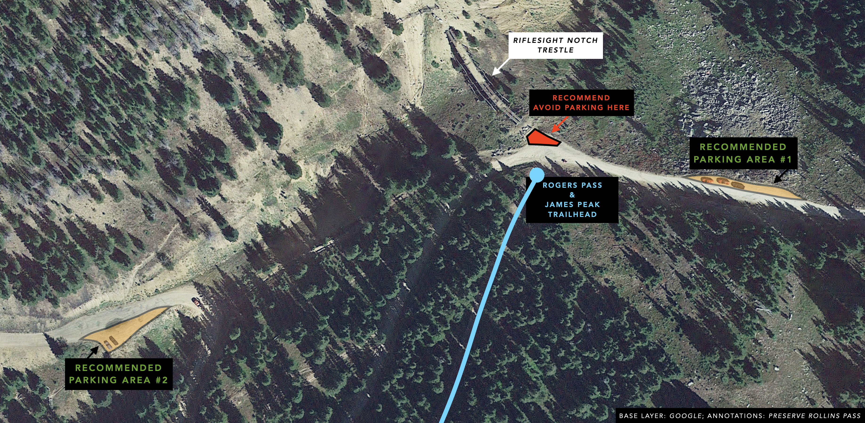
Rogers Pass is named after Andrews N. Rogers, who did much of the preliminary work in locating the Moffat Tunnel through the James Peak hogback decades before it was constructed. Rogers, a resident of Central City in Gilpin County, died in 1890. On September 26, 1903, “the board of supervisors of the Moffat [R]oad at a meeting and at the instance [sic] of Mr. David H. Moffat passed a resolution, which is recorded in their minute book No. 1, page 113, as follows: ‘Subject 13, Rogers Pass—Action—After due consideration, it was unanimously agreed that the pass over the main range near where our main line crosses, be officially designated as ‘Rogers Pass’ and the name be indicated upon the maps, and that Mr. Fred Rogers be notified of said decision of the board.'”
“Mr. Rogers and David H. Moffat were personal friends of long standing and Mr. Rogers on several occasions acted as consulting engineer regarding matters concerning the Rio Grande road.” In short, “the Moffat [T]unnel is being built exactly where engineers for various interests and at various times for more than 50 year[s] have finally decided upon as the shortest and best point to penetrate the range.”
There are several, however, the two most famous are likely Margaret Crawford and Doc Susie. In 1874, Margaret Emerine Bourn Crawford made her way across Rollins Pass to ultimately settle in Steamboat Springs. She and her family encountered a 2-hour blizzard in June and she wrote of the condition of the road, “the bumping was so hard I thought I was nearly dead.” Several decades later, Susan Anderson, MD—Doc Susie—made her way into Fraser by way of the Moffat Road over Rollins Pass and was one of the first women to practice medicine in Colorado. She served as a physician in Grand County and was instrumental during the 1918 pandemic; she was posthumously inducted into the Colorado Women’s Hall of Fame in 1997.
As with other period postcards, a cross made of snow can subtly be seen in the background of many scenes near the summit of Rollins Pass. This iconography seems to be an early attempt at photograph manipulation as a cross does not appear naturally at this location in any season on Rollins Pass. Dr. Jason LaBelle wonders whether the cross was meant to tug at the heartstrings of religiously aware travelers who sought pristine, pure, and untouched lands above timberline. Elsewhere in Colorado—specifically in the Sawatch Range in Eagle County—there is the Mount of the Holy Cross. The popularity of William Henry Jackson’s 1873 photograph of this natural feature (intersecting ravines, roughly 1,500 feet in length) and Thomas Moran’s 1875 painting likely were replicated to other areas in Colorado, including Rollins Pass.
Many visitors, particularly from out of state, are not acclimated to the high elevations found on Rollins Pass. The lower atmospheric pressure (40 percent lower on the summit when compared to sea level) can cause altitude sickness, rapid dehydration, and if ignored can progress to high-altitude pulmonary or cerebral edema. Unexpected summer storms with violent lightning or sudden blizzards can also surprise tourists, who lose all sense of scale above timberline.
The townsite of Arrow once accommodated over 2,500 people, more than the towns of Winter Park and Fraser combined, as of the 2020 decennial census. The main street sported gas lamps—an amenity only seen in large cities such as Chicago, Illinois, at that point in time. Arrow was built around a wye to support the railroad efforts on Rollins Pass. Since wyes appear triangular and are shaped like arrowheads, the name took hold—Arrowhead, later shortened to Arrow. Arrow is truly a ghost town now. The main street has been lost to history, although there are a few graves nestled in a small grove of pine trees at the top of a hill overlooking the ski area at Winter Park. Arrow had at least 11 saloons as well as cafés, restaurants, several hotels, a post office, a schoolhouse, a grocery store or commissary, loading facilities, a pharmacy, four sawmills, a stockyard, and other buildings, including homes. The Elk Saloon was owned by Mart Wolf, who set fire to his establishment in hopes of collecting an insurance payout of $1,000. Unfortunately, the fire quickly spread, and Arrow was almost all but snuffed out of existence. The Moffat Road and townsite of Arrow on lower Rollins Pass face new challenges in the 21st century. Distressingly, this national historic district is threatened by development pressures; the Town of Winter Park has identified this land as within the “three-mile planning area,” and it is anticipated “this area will be annexed into the [town] as part of [a] property exchange.” One federal land exchange has been attempted, and advocacy efforts as well as permanent protections are needed.
Jenny Lake, also known as Dixie Lake, was dammed to feed water to thirsty railroad boilers, leading several texts to erroneously conclude this lake is a man-made creation.
No—motorized vehicles are able to drive from a turn-off of the Rollins Pass Road to a small spur that leads to Jenny Lake. This portion of road is blocked by buck-and-rail fencing deployed by the US Forest Service to prevent resource degradation and damage. From that small dead-ended pull-off, it’s a 450-foot walk with 40-feet of uphill, to get to the shoreline (one-way).
At the summit, the US Weather Bureau’s observation station was placed atop a large water tank adjacent to the tracks. The prevailing wind direction was west, the lowest temperature recorded was -30 degrees Fahrenheit (in February 1910), and the most monthly snowfall was in March 1912 with 72.5 inches of snow.
Yes! Denver architect Edwin Moorman designed the square Moffat Station building that would serve as the Denver terminus of the Denver, Northwestern & Pacific Railway. In January 1906, construction of the Moffat Station began. The completed building represents Georgian Revival architecture and is now the focal point of a retirement community complex.
As many as fifteen different agencies have been involved with a single rescue mission. Overall, more than two-dozen various agencies have been involved historically with rescues on the pass: Boulder County Sheriff’s Office, Gilpin County Sheriff’s Office, Grand County Sheriff’s Office, Rocky Mountain Rescue Group, Front Range Rescue Dogs, Boulder Emergency Squad, Eldora Ski Patrol, City of Boulder Water Utilities Department, U.S. Air Force Rescue Coordination Center, American Medical Response, Nederland Fire Protection District, Northern Colorado Med Evac, Flight for Life Colorado, Colorado Division of Fire Prevention and Control, Regional Transportation District, Alpine Rescue Team, Nederland Fire Department, Timberline Fire Department, Grand County Search and Rescue, Colorado Army National Guard, Colorado Search and Rescue Association, Grand County EMS, Classic Air Medical, Grand County EMS Mountain Medical Response Team, Winter Park Ski Patrol Dog Team, and the Colorado Avalanche Information Center (CAIC).
Yes for the west side; no for the east side. The west side of Rollins Pass (near Winter Park) has groomed trails per this USFS snowmobile map. Use caution: cross-country skiers, snowshoers, and others recreate on these trails as well: expect to see someone around every curve. The east side of Rollins Pass (near Rollinsville) is not groomed nor maintained in the winter/spring. Further, one can expect large bare spots adjacent to sizeable 5-foot-tall snow drifts at various elevations, along with dangerous avalanche territory.
An over-snow vehicle is a motor vehicle that is designated for use over snow and that runs on a track or tracks and/or a ski or skis while in use over snow.
The quality of snow that persists into the summer is typically described as “mashed potatoes.” The fine flakes and powder of winter’s snows have melted and refrozen to become large grains of ice in the shade and a wet slush in the sunshine. Care should continue to be exercised for avalanche danger—avalanche deaths have occurred in the summer in Colorado, as late as July.
No—per this Regional Order, “possessing, discharging, or using any kind of firework or pyrotechnic device” is prohibited in the Arapaho and Roosevelt National Forest. Exploding targets, tracer bullets, and fireworks are never allowed on National Forest System lands.
There are three lakes located in Grand County in the Rollins Pass area: Deadman’s Lake, Pumphouse Lake, and Corona Lake.
There are seven lakes located in Boulder County in the Rollins Pass area: King Lake, Bob Lake, Betty Lake, Skyscraper Reservoir, Woodland Lake, Yankee Doodle Lake, and Jenny Lake.
There are many lakes located in Gilpin County in the Rollins Pass area: Forest Lakes (8), Arapaho Lakes (5), Crater Lakes (5), Iceberg Lakes (6), Clayton Lake, Heart Lake, Rogers Peak Lake, and Karel Park Lake. Numbers listed above include small ponds connected to the same lake system and/or drainage.
If you need help from a helicopter in the backcountry, do not wave with one arm—pilots interpret this as “hello.” Instead, always signal a ‘V’ or a ‘Y’ with both arms. If you do not need help signal an ‘N,’ which is one arm up, the other down; an ‘X’ with your arms means ‘need medical aid/assistance.’ Review the International Civil Aviation Organization (ICAO)’s appendix in their manual International Standards And Recommended Practices For Search and Rescue.
The first hints of autumn in the high alpine region typically occur between the last week in July and the first week in August when tundra grasses begin to change colors. Check our road status page for current fall/autumn color status.
Yes, please view this Jotform link. Note that per the Indian Peaks Wilderness Alliance, “Hiking, climbing, and many outdoor activities can be dangerous and can result in injury. Additionally, trail conditions may change from day-to-day and even hour-to-hour. This website does not represent to the accuracy of any information contained herein. Please use the information contained on this website at your own risk and do not depend on the information contained on this website for personal safety or for determining whether to attempt any hike, climb, route or other outdoor activity.”
In July 1905, a “mountain along the Moffat [R]oad that rears its snow-scarfed peak high over the heads of its fellows, but as yet has not been named by the government survey” was formally christened as “Mount Epworth” on Saturday, July 8, 1905 and “the geographical survey… issued a certificate… stating that this peak shall be hereafter known as Mount Epworth, and shall so appear on the maps of the government,” penned the Rocky Mountain News. That same week the same newspaper also wrote, “The Epworth league was so named for the purpose of making memorable the name of Epworth. The little town near London where John Wesley first saw the light of day was named Epworth. Since the founder of Methodism came to the man’s estate the name has had great significance among those who followed the tenets of the faith he established…. It was urged by many that the committee should bury in the base of the natural monument of John Wesley’s birthplace a history of his life and an account of the church he established.”
No, the closest tunnel is Needle’s Eye Tunnel, located 1.80 miles downgrade to the east from the sign at the summit of Rollins Pass.
The foundation above the summit of the pass—on the way to King Lake—is the foundation of the Corona dining hall.
No, the Sphinx Head Tunnel is located between Lincoln Hills and Rollinsville.
MOFFAT TUNNEL: FREQUENTLY ASKED QUESTIONS (FAQs)
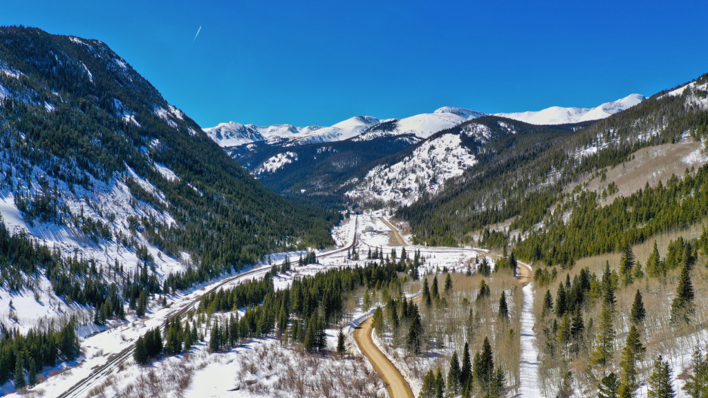
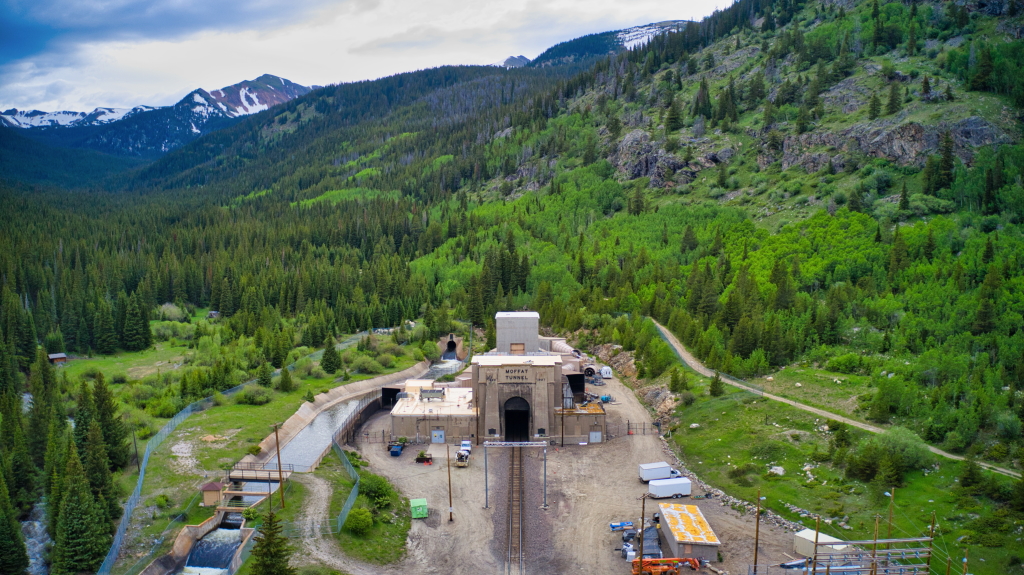
The 6.2-mile-long Moffat Tunnel spans two counties: Gilpin County (East Portal) and Grand County (West Portal).
The Arapaho refer to the area as hooxee hookute’ (wolf’s canine).
The Moffat Tunnel was bored through a shoulder of James Peak located on the Continental Divide.
A train moving east to west through the Moffat Tunnel begins at an elevation of 9,196 feet at the East Portal, ascends a very gentle 0.3 percent grade, and 14,054 feet later, reaches the tunnel’s apex at 9,238 feet above sea level. Descending the remaining 18,746 feet toward the West Portal, two different grades are encountered (0.9 percent and 0.8 percent) toward the portal’s elevation of 9,098 feet.
The construction of the Moffat Tunnel was, “remarkably accurate” penned McMechen, “To guard against possible error due to refraction of the sun’s rays, the projected line into the tunnel was checked repeatedly against the surface line, under the direction of Betts, office engineer in charge of surveys. For night work powerful lights, permanently located at each portal, were used as sights, and long and short sights were taken. The engineers would leave the portal camps during the afternoon and make the steep ascent in time to arrive at the summit before dark. Conditions were best on cool nights. Permanent targets also were erected on either side of the broad summit, and from these positions sights were taken on the target lights far below in the valleys. Many a wild night above timberland was thus spent in checking and rechecking alignment. A small shelter house at an elevation of twelve thousand feet formed their only protection from the elements, and, on one occasion, a party escape freezing by sitting before a wood fire all night, while a polar blizzard tugged at the frail cabin, and the mercury fell to forty degrees below zero.”
Alignment devices, known as Transit and Sunflower were used to not only keep the alignment straight but also to measure cross sections of the tunnel. Very, very few photographs exist, and Preserve Rollins Pass has only seen two photographs of this equipment; both of which are in our collection.
The contractor for the construction of the Moffat Tunnel was Hitchcock & Tinkler.
The Moffat Tunnel opened to rail traffic on Sunday, February 26, 1928.
In short, the Moffat Tunnel was an extraordinarily expensive undertaking; to change the ‘7’ on each portal to an ‘8’ would have been an additional $80 in an unnecessary expenses. The targeted year for opening the Moffat Tunnel was 1927, and while the tunnel was holed through in February of 1927, enlargement operations continued through much of that year, pushing the opening to 1928.
The Moffat Tunnel opened for rail traffic in 1928 and has seen continuous use since that date. The Moffat Tunnel was also crucial to helping win World War II as more than 30 defense trains hurried through the tunnel daily.
No—this is an active rail tunnel; please do not trespass on railroad property.
No. However, of interesting note is the 1922 law authorizing the Moffat Tunnel “specifi[ed] that the bore should be used by cars as well as trains.” Several Steamboat Pilot articles mention the plan was to ferry cars through the tunnel “on electric-powered railroad flatcars” and then collect a “toll charge.” If such a plan were enacted, it would slash approximately 28 miles and nearly 4,000 feet of total elevation from the present route up, over, and down Berthoud Pass.
Railcars that have two layers of intermodal containers cannot be sent through the Moffat Tunnel.
40 MPH.
The creation of the 6.2-mile-long Moffat Tunnel through the Continental Divide was a monumental undertaking; 400 tons of drill steel were used for the 700 miles of drill holes made through the heart of James Peak. Dynamite—1,250 tons of it—loosened 750,000 cubic yards of rock for excavation, the equivalent of 1,600 freight trains, each 40 cars long.
The East Portal company town had a 24-hour mess hall serving high-quality food, a six-bed hospital with an operating room and x-ray machine, a movie theater (admission was 35¢), women’s bridge clubs, a post office, and a school. The whole operation was dry—the Moffat Tunnel was built entirely during Prohibition—and the town of East Portal is one of the few communities in early Gilpin County without a saloon.
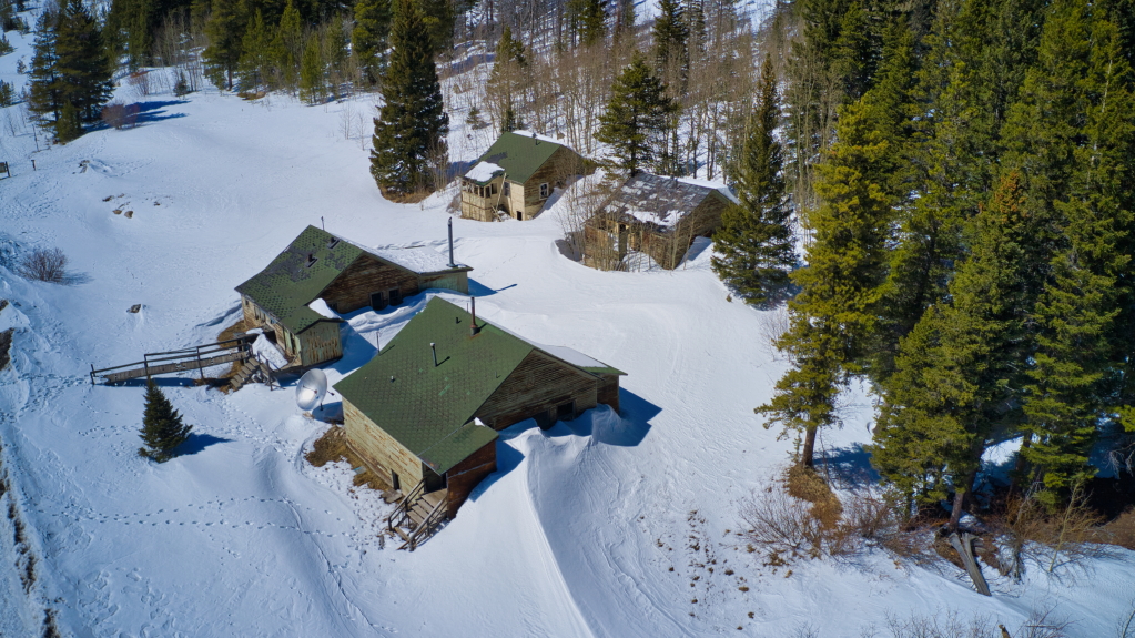
At East Portal, the most specialized buildings such as the compressor house, machine shop, and powder magazine, all located closest to the tunnel entrance toward the south, were demolished first. The most adaptable buildings continued to be used through the early 2000s as housing for workers who helped maintain the Moffat Tunnel. This solves the mystery for those trying to reconcile the buildings’ historic use and yet see a sizable, aged satellite dish outside of the cottages.
Yes; the five remaining cabins at East Portal were listed in 2020 as one of Colorado’s Most Endangered Places by Colorado Preservation Inc. While Mother Nature and Father Time exert tremendous forces on the outside of these structures, heartbreaking vandalism seeks to shatter these buildings from within. The West Portal held 200 more workers, yet none of the historic structures remain. To view the 2020 Endangered Places Program announcement, tap here.
Yes, there is a time capsule in the façade of the East Portal of the Moffat Tunnel. The original time capsule was placed in a 50-year vault and was opened Saturday, February 25, 1978. A second vault holding a time capsule is scheduled to be opened on Saturday, February 26, 2028—the 100th anniversary of the first official train through the tunnel. This capsule contains newspapers, photos, tickets, and booklets from the 50th anniversary.
Preserve Rollins Pass has the original receipt book from the first train passage through the Moffat Tunnel—a rare gem that should absolutely be showcased at the 100th anniversary celebration!
The plaque on the East Portal says the current time capsule is the “Property of the Moffat Tunnel Commission and the Intermountain Chapter National Railway Historical Society.” The Moffat Tunnel Commission was dissolved February 1, 1998; the Colorado Department of Local Affairs is the custodian of and has administrative authority over the Moffat Tunnel Improvement District, which owns the rail tunnel known as the Moffat Tunnel. (The pioneer bore—located 75 feet to the south of and parallel to the rail tunnel—was later converted into The Moffat Water Tunnel and sold to the Denver Water Board in 1998.)
(Seal of Colorado)
MOFFAT TUNNEL
THE MOFFAT TUNNEL IMPROVEMENT DISTRICT
—
Created by extraordinary session of the Colorado Legislature 1922, to construct the Moffat Tunnel
Act signed by Governor Oliver H. Shoup
May 12, 1922, Commission members appointed May 22, 1922.
–
Division No. 1
W.P. ROBINSON
C. MacA. WILLCOX
W. N.W. BLAYNEY
–
Division No. 2
CHAS. H. LECKENBY
CHAS. J. WHEELER
—
This commission elected in July 1923, re-elected in July 1925, and appointed by Governor William H. Adams in 1927, in accordance with amendment by the 26th Colorado General Assembly making the commission appointive by governor.
(Seal of Colorado)
MOFFAT TUNNEL
Visioned by David H. Moffat
Constructed by Moffat Tunnel Commission
—
W.P. ROBINSON, President
CHAS. J. WHEELER, Vice Pres.
C. MacA WILLCOX, Vice Pres.
W. N.W. BLAYNEY, Treasurer
CHAS. H. LECKENBY, Secretary
GEORGE LEWIS, Chief Eng. & Gen. Manager
CLIFFORD A. BETTS, Office Engineer
BURGIS G. COY, Resident Engineer
NORTON MONTGOMERY, Gen. Counsel
ERSKINE R. MYER, Attorney
NELLIE H. VanDEUSEN, Auditor
–
Board of Consulting Engineers
D.W. BRUNTON
J. WALDO SMITH
J. VIPOND DAVIES
L.D. BLAUVELT
–
HITCHCOCK & TINKLER, INC.
Contractors
F.C. HITCHCOCK, President
C.C. TINKLER, Vice President
A.H. BAER, Secretary-Treasurer
—
COMMENDATION
To all members of the organization whose concerted efforts have brought this mighty work to completion.
Yes! The Gilpin County Board of County Commissioners approved the East Portal Camp Cabins at the Moffat Tunnel to be a Gilpin County Local Historic Landmark (Designation LM-23-1) on June 13, 2023, by a vote of 3-0. Learn more here.
PURCHASING OUR AUTOGRAPHED BOOKS: FREQUENTLY ASKED QUESTIONS (FAQs)
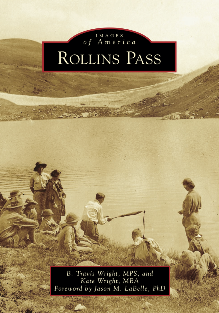
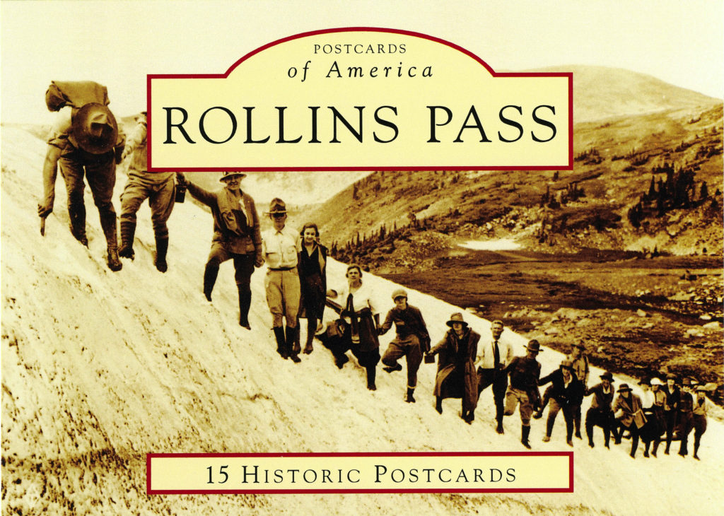
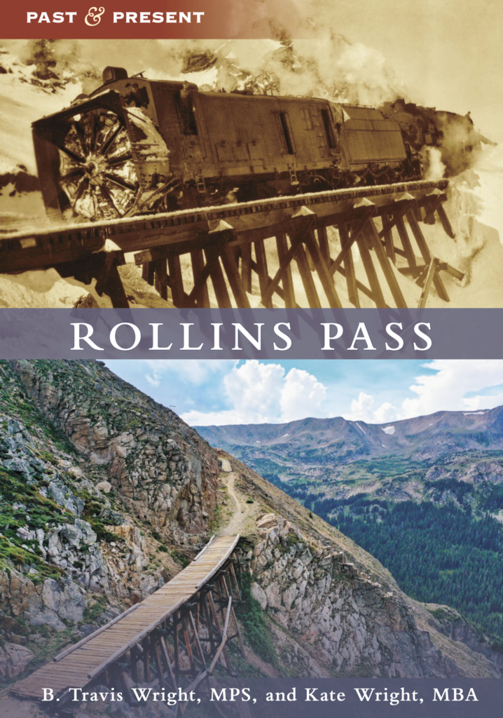
Yes! …and no. If a book is to be inscribed, please triple-check the spelling of the name(s) we will be making the book out to—we use permanent ink! Travis and Kate want to engage with our readers in a way that appreciates and celebrates the history of Rollins Pass. Personalization requests that run contrary to the dedications or acknowledgments printed in our books, messages about opening/closing the pass, text that contains abbreviations or profanity of any kind, or messages of a hateful or political nature will be canceled and fully refunded.
We always sign on the title page by the printed authors’ names, rather than on the first page; for both our 2018 and 2022 books, our signatures can be found on page 3.
Our processing and handling times are typically within two business days, with most orders averaging same business day or next day for handoff to the postal service. Orders are not shipped on days our local post office is closed (Saturday afternoons, Sundays, and federal holidays).
We send all orders with speedy shipping to your front door or mailbox in a USPS Priority Mail Flat Rate Envelope. Shipping is the same cost for either one or two books.
Signed paperback books are also available for local pickup without shipping charges. Reach out to us if you are in the Grand County and Gilpin County areas—if our route takes us that way, we can meet!
While extraordinarily rare, if your tracking number happens to show “Tracking number created” (or something similar, like “Label Created, not yet in system”) for a few days, please wait until one weekend passes as it is usually over the weekend that USPS catches up with their missed scans. We sincerely apologize for the inconvenience.
We fulfill orders almost immediately as we receive them. If your shipping address was incomplete or is incorrect, we are unfortunately not able to change it before it ships. Once you receive the tracking number, you (the receiver) can contact USPS and complete or correct the address. If you are having trouble with this process, please contact us at [email protected] once you’ve received a response from USPS.
Due to the nature of our custom fulfillment process, we are unable to accept returns or exchanges at this time. We do guarantee shipment and if there is any damage to your order, please email us with photos of the damage within 72 hours of delivery and we will replace your order right away.
If you received a damaged item, please notify us within 72 hours of delivery and we will happily replace the damaged item(s) with the same shipping as per the original order. Please include well-lit images detailing the damage to qualify for replacements.
Yikes—while extraordinarily rare (less than a handful of times across several years), it’s possible an order could get derailed. Please reach out to us with any information you have on your end: date of the purchase, transaction ID, order number, and/or email address; then on our end, we’ll determine why the order may have gotten lost in the woods and help set things right. When this happens, we add something extra to your shipment for your patience.
Please note that our processing time is up to two business days to fulfill your order and it ships after that. If you are ordering something for a specific date, please account for this processing and shipping time.
If you are one of the two dozen people who made our first book possible or one of the more than six dozen people who helped make our second book possible, your copy is on us! Preserve Rollins Pass routinely makes donations from our book sales. The proceeds of our first royalties went to Colorado State University’s Archaeology Field School—they conduct field research and archaeology on Rollins Pass in the summers. We have also donated over a hundred books to local libraries, master’s degree and PhD students, preservation groups, county governments, and land managers. We are also committed to helping rebuild the home libraries of those who lost everything in the East Troublesome Fire of 2020—including attempting to replace their collection of Rollins Pass books. Per household lost, we provide a complimentary signed replacement of our 2018 book plus a free signed copy of our 2022 book; and, from time to time if/as availability allows, no-cost (and sometimes signed!) replacements of Bollinger’s books “The Rails That Climb” and “The Moffat Road.”
Definitely—and we’ve done this in the past with other historians and local authors. If you’re an author with a recent or even not-so-recent publication, let’s trade books at no cost!
Yes—please reach out to us directly so that we can invoice you separately for international shipping costs. Please note that per the USPS, “Upon delivery, the destination country’s government may require the recipient to pay the shipment’s estimated duties, taxes, and fees, based on their customs assessment of the item(s). The sender does NOT pay these landed costs at this time.” Although USPS does not determine landing costs for the recipient, they do provide us with an estimate, which we can provide to you, the recipient.
It depends on the country and the weight of the package, so please contact us and we’ll work with our local post office to provide a rough estimate to you. In summer 2023, we shipped two books and a postcard pack in a single envelope to Switzerland. The postage costs were $31.20 and the recipient had estimated landed costs of $0 for duties, $14.87 for taxes, $23.25 in fees for an estimated total of $38.12. Combining postage and estimated landing costs brought the total to approximately $70. From Fraser to Switzerland, the total shipping time was 9 days.
Our books are written directly on Rollins Pass in nearly every season with finishing and assembly work completed in both Tolland and Fraser, Colorado. Our books are made in the USA and are printed in South Carolina on American-made paper and manufactured entirely in the United States.
Yes, of course! Each of our books, presentations, and documentaries about Rollins Pass and the Moffat Tunnel involve tens of thousands of hours of work in consultation with experts across the country. We always enjoy reading compelling reviews, yours if we are so honored, and would like to be able to share your words and thoughts on our recommendations page with others.
While our two books cover the same core topics of Rollins Pass and the Moffat Tunnel, the 2022 book is not a republication of our 2018 work—in fact, there’s very little that’s duplicated between the two books. Our 2022 book discusses completely new details and information about Rollins Pass that transpired in the four years between publications. The 2022 work has never-before-published and extraordinarily rare imagery meticulously restored from the originals: all historic photographs are printed in black and white with modern counterparts in full color. While our first book involved two dozen people, our second book involved the efforts of more than six dozen experts to help tell this area’s vast story.
Our growing list of experts is found here on our ‘With Gratitude‘ page.
GENERAL TOPICS: FREQUENTLY ASKED QUESTIONS (FAQs)
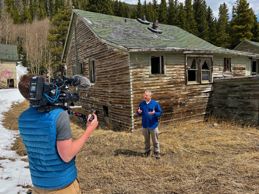

If you would like to collaborate on a project, invite us to give a presentation, or feature Travis and Kate in a documentary or article, we welcome all inquiries. Please contact us at [email protected] and we will respond in a timely manner.
Yes! Our presentations involve thousands of hours of work in consultation with experts from around the country, including archaeologists, botanists, zoologists, geodesists, research geologists, land managers, avalanche experts, and historic preservation authorities—including the State Archaeologist as well as Colorado’s first Tribal Historic Preservation Officer. Every single presentation we deliver is distinctive and crafted from a place of deep passion for this incredible slice of Colorado—the audience recognizes this with high engagement marks and responses such as:
• “Thank you for sharing with all the attendees the magic that is Rollins Pass.”
• “I’ve seen thousands of presentations, and this has to be the best, neat, and cool, understandable, colorful presentation I have ever seen.”
• “Travis is a wonderful and inspiring presenter. Travis offered very great, helpful, clear steps to take in improving communication in difficult situations. This will be useful in lots of scenarios to do with current preservation projects.”
Absolutely! While we don’t own a copy of the rare silent film, The White Desert, we know where to source the only copy in existence! We also partner with superb pianist Hank Troy to provide live accompaniment. Regardless of venue size: whether a private screening for a dozen VIPs or for a crowd of several hundred people, we require 12 weeks’ notice (preferably more) to work out film shipment logistics, technology requirements, venue, and event planning.
At Colorado Preservation, Inc.’s 32nd Annual Dana Crawford & State Honor Awards event held on Thursday, June 9, 2022, B. Travis Wright, MPS of Preserve Rollins Pass was recognized and celebrated with a State Honor Award for excellence in historic preservation and preservation leadership for over a decade of work on Rollins Pass in Colorado. The story of Travis’ efforts on Rollins Pass for his State Honor Award were shared by Holly Kathryn Norton, PhD, State Archaeologist and Deputy State Historic Preservation Officer (SHPO) as well as by Garrett W. Briggs, a Southern Ute tribal member and Colorado’s first Tribal Historic Preservation Officer (THPO). The video shown at the awards ceremony and more information can be found here.
We adopted the trail in the summer of 2016 as part of the Adopt-A-Trail Program (AATP) administered under the auspices of Headwaters Trails Alliance (HTA) and the United States Forest Service (USFS)—all work is done on a volunteer basis. N76 is a 1.73 mile Class 2 Trail known as Riflesight (named for the famed Riflesight Notch Trestle), on the west side of Rollins Pass.
For well over the last decade, in the summers and early autumn, we are on the pass 3-5 times per week and log roughly 20-30 miles of hiking weekly. In winter and early spring, we’re on the pass on average 2 times per week.
I think we’ve lost track over the years! Approximately half of our flat tires were caused by punctures from railroad hardware in the road (old nails and rusted screws), while the remainder of flats were caused by sharp rocks causing blowouts of a sidewall or in between the tire tread. Always carry a spare and a jack as there’s not always cell signal to call for help!
It’s true: our rescue pup’s middle name was Rollins and he is pictured on page 55 of our second book on Rollins Pass! Rest in peace our sweet friend—play forever in that warm summer glow atop Rollins Pass ❤️🌈.
Yep, it’s true! Just as it was with history, Moffat’s chapter came after Rollins’ chapter (see immediately above), and so our current rescue dog is named after the Moffat Tunnel and the Moffat Road! He also has a coat of fur that looks like a puff of coal smoke, so that adds credibility to his name, too!
Absolutely! Connect with B. Travis Wright, MPS here and with Kate Wright, MBA here. Our websites can also be found here (Travis) and here (Kate).
Absolutely—we likely have the largest collection of still, video, timelapse, and archival B-roll footage (ground-based and aerial) that exists anywhere documenting the terrain and every feature or landmark of Rollins Pass (Corona Pass) from various angles, in every season, and in different lighting conditions. All drone photography was flown under an FAA Part 107 certificate and all flights complied with the rules set forth by the FAA for UAS flights within the United States; no drones took off, landed, or were operated from wilderness. B. Travis Wright, MPS is a representative with the FAA Safety Team (FAASTeam) as a DronePro to help establish a positive safety culture within the aviation community.
We’ve collaborated with many newsrooms for projects over the years and we have a fast internet connection to upload large format photographs and high-definition video files to your team quickly. If the news story is urgent, please text us (preferred) or call us twice within 3 minutes and we will do our best to respond to you.
Our footage library includes, but is not limited to: Rollinsville, Baltimore, Tolland, Mammoth, East Portal, Ladora and Tunnel 31, Antelope, Spruce Wye, Yankee Doodle Lake, Guinn Mountain, Jenny Lake (Dixie Lake), Dixie Siding, Needle’s Eye Tunnel, Devil’s Slide Trestle and Phantom Bridge—known collectively as the Twin Trestles, Buttermilk Falls, Corona, King Lake, Mount Epworth, Corona Lake, Pumphouse Lake, Deadman’s Lake, Ptarmigan Point, Sunnyside, Riflesight Notch Trestle, the Loop and Tunnel 33, Ranch Creek Wye, Forest and Morgan Spurs, Arrow, Pacific Siding, Irving Spur, West Portal, the towns of Winter Park, Fraser, and all the way to Tabernash… and everywhere in between.
The CBS4 team knew they wanted to interview us on Rollins Pass; however, it would have been another hour—one way—to film on Guinn Mountain and they had tight deadlines to be back within signal. As we had adopted N76, it made sense to stop and film at that location to reinforce the message of establishing the need to care for trails and advocate for the irreplaceable history of the pass.
The Gilpin County Historic Preservation Commission (HPC) consists of preservation commissioners appointed by the Gilpin County Board of County Commissioners. The HPC ensures preservation issues, programs, policies, landmark designations, and stay-of-demolition reviews adhere to criteria consistent with the National Historic Preservation Act and the Secretary of the Interior’s Standards for Archaeology and Historic Preservation. To our knowledge, the Gilpin Historical Society operates museums and curates artifacts.
Writing books is more a labor of love than it is a source of revenue—we donated our first book’s royalties to Colorado State University’s field school students who perform archaeology fieldwork atop Rollins Pass in the summers. If your content is selected and will be used, we would be happy to give you a signed copy of the book when it publishes. We would also give you/your family credit in the book for each photo as well as special call-out in the Acknowledgments of the upcoming book and special mention at our book launch event.
Good news: we can scan the media for you (for free) and send you all of the photos digitally, too, to help preserve these memories for future generations.
We can scan large format photographs, newspapers, maps, and charts; negatives, slides, and Polaroids. For video and/or audio tapes, we can accept any and all analog formats.
No limit—whether you have just one, dozens, hundreds, or thousands of photographs/items—we’ve got both time and passion for any size job!
We’re accepting any image, but would love to see anything that would make a reader turn the page, see your photo, and say, “WOW!”
No worries—we’ll still accept it and we can determine approximate, if not precise, dates.
Preserve Rollins Pass encourages the responsible visitor to take care of the pass along with its vast 12,000 years of history for the next generation; we also safeguard Rollins Pass and Moffat Tunnel chronology, photographs, stories, structures, and landscapes—read more.
HAVE FURTHER QUESTIONS?
Do you have a question that could be or should be answered on our frequently asked questions page? Reach out to us!
The primary purpose of our work is to inform the public.
