Fire Information & Restrictions
Help Preserve Rollins Pass by following common sense rules on fire safety; be sure you know when and where you can have campfires.
YOU CAN PREVENT OUT OF CONTROL CAMPFIRES
Just one unattended campfire can completely destroy the spectacular setting of Rollins Pass and adjacent areas for a generation, if not longer. Colorado has a warm, dry climate, coupled with high winds: please recreate with care and consider options like camp stoves or grills that have an on/off switch.
At Preserve Rollins Pass, we lead by example. Since July 2011, we’ve refrained from campfires, reflecting our decision to help preserve the pristine nature of the backcountry. To us, the flickering ambiance of a campfire is not worth potentially compromising Colorado’s natural beauty. This decision reflects the deep respect we have for the area and our responsibility as stewards of this magnificent place.

Campfires that burn out of control are the leading human cause of wildfires in Colorado. Between 2018-2022, 89% of wildfires in the United States were caused by people, according to the U.S. Department of Interior.
RUNAWAY CAMPFIRE ON ROLLINS PASS IN JUNE 2012
“U.S. Forest Service Sulphur Ranger District crews responded to an escaped campfire in the Corona Lake area on Saturday evening, June 23. The fire was the result of an abandoned campfire near Deadman Lake (less than one mile south of Corona Lake). Engine 681, the Shoshone National Forest Engine 611 and an engine form [sic] Granby Fire Department responded and controlled the fire at around 9 p.m. The fire had grown to about 150 square feet, as other campers in the area had already done some work on the fire prior to the crews’ arrival.”
“Runaway Campfire,” Sky-Hi News—June 27, 2012
While the above news article is well over a decade old, unfortunately, in a 31-day period spanning June-July 2023, the wildfire prevention staff at the Arapaho Roosevelt National Forest put out 66 abandoned campfires that visitors left burning plus three escaped campfires. Please recreate responsibly.
THERE ARE NO DEVELOPED CAMPSITES ON ROLLINS PASS
When fire bans/restrictions are in effect, no campfires are allowed—there are no ‘developed’ campsites on either side of Rollins Pass, no matter how well established a site or a rock fire ring appears. Dispersed (or undeveloped) campsites do not have metal fire rings, picnic tables, numbered posts, garbage service, nor toilets, and visitors are required to properly store and pack out all food and trash to prevent negative interactions with bears and other wildlife. Rocks do not make a permanent fire ring.
REVIEW DETAILS OF ANY FIRE BANS AND FIRE RESTRICTIONS
Fire restrictions can originate from many places, causing confusion for the public. Federal agencies such as the U.S. Forest Service, Bureau of Land Management, and the National Park Service can impose restrictions on the public land they manage. Individual states can impose restrictions on state-managed land. Counties may impose restrictions or bans on private lands within county borders. This can be very confusing and frustrating, especially when adjacent lands have different restrictions depending on the administering agency.
REVIEW ANY ACTIVE FIRE INCIDENTS
View the State of Colorado page on InciWeb. Alternatively, review the InciWeb Incident Table for any active/open fire incidents. When the page loads, use your browser’s search function to look for Colorado.
CHECK FOR WILDFIRE-RELATED TFRs (TEMPORARY FLIGHT RESTRICTIONS) FOR MANNED AND UNMANNED AIRCRAFT
View this page for any TFRs (temporary flight restrictions) related to Rollins Pass and the surrounding areas in Colorado. Per the FAA, “The FAA maintains the safety and efficiency of our National Airspace System. As with cars on the road, there are rules that cover aircraft in the sky to ensure safety. In special circumstances, the FAA may temporarily restrict access to certain designated areas of our airspace, much in the same way a city or state may block off access to a street when necessary. These airspace restrictions are called Temporary Flight Restrictions (TFRs) and are communicated to pilots through Notices to Air Missions (NOTAMs). They restrict aircraft (including drones) from operating without permission in a certain area for a limited time. You must always check NOTAMs prior to your flight.”
In July 2023, the Devil’s Thumb Fire was started by lightning, and a short time later that day, a TFR was put in place to provide a safe environment for fire fighting aircraft operations. As a result, the five mile TFR extended over much of the towns of Fraser and Winter Park, plus both sides of Rollins Pass and includes the Riflesight Notch Trestle, the summit, Yankee Doodle Lake, and more—covering from the surface up to and including 14,500 MSL (mean sea level).
If you fly, they can’t—please avoid any TFRs whether by manned or unmanned aircraft. Leave your drone at home!
Read more on drone regulations related to the Rollins Pass area.

JAMES PEAK WILDERNESS: CAMPFIRE RESTRICTIONS
Campfires are always prohibited in the James Peak Wilderness per this US Forest Service page.
INDIAN PEAKS WILDERNESS: CAMPFIRE RESTRICTIONS
Campfires are prohibited in the Indian Peaks Wilderness on/near Rollins Pass by King Lake, Betty Lake, Bob Lake, Buttermilk Falls, Skyscraper Reservoir, Woodland Lake, and along the South Fork of the Middle Boulder Creek—these areas are in the Woodland BZ and Middle Boulder BZ where campfires are prohibited per this US Forest Service map; the only exception is on the ridge west of the Continental Divide (above Corona Lake), known as the Columbine Backcountry Zone (BZ).
CAMPFIRES
Improperly doused or misplaced fires are one of the leading causes of wildfires. Before starting a fire, check your area’s current restriction status to make sure conditions are safe for an open flame. Never burn in high winds or leave a fire unattended. Do not make excessively large fires as these can quickly get out of control—three (3) feet wide is the max. Make sure to only burn local firewood and nothing else: keep trash and food scraps out of the fire. Also, keep a shovel, an extinguisher and water nearby to quickly put out the fire, should the need arise. Completely extinguish a fire with sufficient dousing and cover with dirt before leaving the campsite. All outdoor fires must be OUT COLD!
RED FLAG WARNINGS (FIRE WEATHER WARNINGS)
A Red Flag Warning, also known as a Fire Weather Warning, is a forecast warning issued by the National Weather Service to inform area firefighting and land management agencies that conditions are ripe for wildland fire ignition and rapid propagation. After drought conditions and when humidity is very low, and especially when high or erratic winds (which may include lightning) are a factor, the Red Flag Warning becomes a critical statement for firefighting agencies. They usually include the daily vegetation moisture content calculations, expected afternoon high temperature, afternoon minimum relative humidity and daytime wind speed. To the public, a Red Flag Warning means high fire danger with increased probability of a quickly spreading vegetation fire in the area within 24 hours. Always check the weather and DO NOT start any outdoor fires during Red Flag Warnings.
WHAT DO THE VARIOUS STAGES OF FIRE RESTRICTIONS MEAN?
STAGE 1 FIRE RESTRICTIONS
- No outdoor fires EXCEPT in developed campgrounds or picnic areas with permanently constructed fire grates and/or charcoal grills (because Rollins Pass does not have any developed campgrounds or picnic areas, this means no outdoor fires under Stage 1 Fire Restrictions)
- No use of open flame torches or explosives
- No operation of any internal or external combustion engine without a spark arresting device, properly installed, maintained and in effective working order
- Smoking is only permitted in an enclosed vehicle or building, or while stopped in an area at least 3’ in diameter that is clear of all flammable materials
- Exceptions:
- Petroleum-fueled stoves, grills, lanterns and heating devices are permitted only if they have an on/off switch and meet fire underwriter’s safety specifications
- Owners/leasers of residences may have fires on their private property in permanently constructed fire rings/pits and charcoal grills
- Persons with a special permit specifically authorizing their activity
STAGE 2 FIRE RESTRICTIONS
- No outdoor fires or campfires of any kind
- No use of open flame torches or explosives
- No operation of any internal or external combustion engine without a spark arresting device, properly installed, maintained and in effective working order
- Smoking is only permitted in an enclosed vehicle or building
- Exceptions:
- Petroleum-fueled stoves, grills, lanterns and heating devices are permitted only if they have an on/off switch and meet fire underwriter’s safety specifications
- Owners/leasers of residences may have fires within the home
- Persons with a special permit specifically authorizing their activity
STAGE 3 FIRE RESTRICTIONS
- All non-essential personnel are prohibited from entering, being upon, or using the lands within a Stage 3 closure area.
ADDITIONAL GUIDANCE
- To report a fire, call 911.
- Before going hiking or camping, check with public land management agencies and counties for fire restrictions or area closures.
- Never leave a fire unattended. Before leaving or going to sleep, completely extinguish your fire by dousing it with water and stirring the ashes until there is no more heat, smoke, or embers.
- Be careful with equipment such as stoves, lanterns, heaters, and grills. Make sure the area is clear of grasses and other fine fuels. Avoid tipping and spilling flammable substances, store fuel away from appliances, and allow equipment to cool.
- Discard cigarettes, lighters, and matches properly. Completely extinguish and dispose of smoking materials and carry them out of Rollins Pass with you.
- Consider alternatives to camp fires during periods of high fire danger.
- Practice Leave No Trace principles—pack out cigarette butts, lighters, and matches. To prevent cigarettes, cigars, or pipes from starting wildfires, always dispose of them in places where they cannot be a source of ignition. Placing smoking materials in a cup of water or an ashtray after use are great ways to prevent them from causing fires. Make sure they are put out or contained so that a still-lit butt cannot blow toward a potential source of ignition. Never simply discard smoking materials on the ground or throw them out a car window.
- If you see smoke, fire, or suspicious activities, note the location as best you can and report it to authorities. Do not attempt to contact suspicious people or try to put out a fire by yourself
- If you see a wildland fire, report its location immediately. Avoid traveling near it.
- Exploding targets, tracer bullets, and fireworks are never allowed on National Forest System lands.
- Pull-off in established dirt areas. Driving on and/or parking on dry grasses can start a wildfire: motor vehicle catalytic converters can reach temperatures of 1,200 degrees or more. Grass fires can travel at 14 miles per hour—and for every 10 degrees of slope, a wildfire can double in speed.
FIRE TERMINOLOGY
Please review the Terminology page on InciWeb for an alphabetized glossary of fire-related terms.
BE MINDFUL OF HIGH WINDS ON AND NEAR ROLLINS PASS AND THE EAST PORTAL OF THE MOFFAT TUNNEL
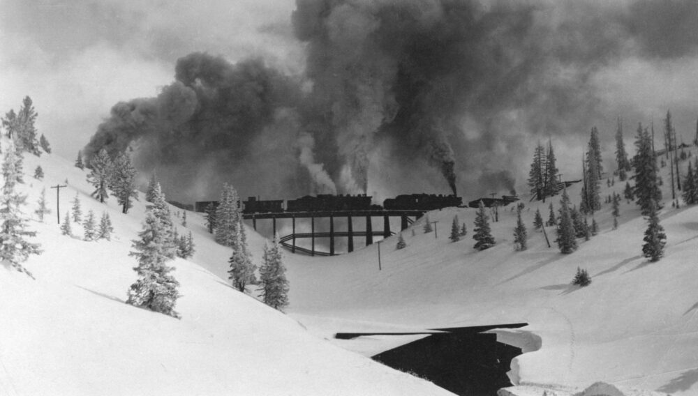
Railroad workers more than a century ago consistently mentioned high winds on Rollins Pass. Times haven’t changed; please follow fire restrictions and, if allowed, keep any campfires small so the wind doesn’t spread fire and threaten the beauty and history of Rollins Pass. Drown your campfire with water, stir the embers with wet soil—ensuring all is soaked—then drown everything again. Everything (including the rock fire ring) should be cool to the touch—if it’s too hot to touch, it is too hot to leave. Learn more here.
Common sense should be top of mind when making plans to camp on Rollins Pass. If there is a wildfire (or wildfires) in the vicinity of Rollins Pass—yet there has been no formal fire restrictions announced, or if it’s been hot and dry, consider proactive alternatives such as using a camp stove or a grill that has an on/off switch, rather than a campfire.
The primary purpose of our work is to inform the public.

